Cascade Range, Washington
Mount St. Helens
1/5Overall difficultyModerateA climb to Mount St. Helens’ crater rim from the south, with Monitor Ridge and Worm Flows approaches to explore.
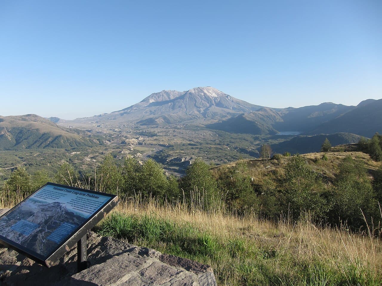 GoToVan · CC BY 2.0
- Distance
- ≈ 12 mi; see measurement notes
- Ascent
- 5,700 ft; see measurement notes
- Descent
- Not available; see measurement notes
- Time
- 7–10 hr; see measurement notes
Measurement notes
- Distance
- Winter Worm Flows return from Marble Mountain Sno-Park. Excludes the shorter summer Climbers Bivouac approach; current snow and permits are separate checks. Route context only; not a training target, technical qualification or current-conditions report.
- Ascent
- Approximate planning magnitude. Mountaineers reports 5,700 ft for its 12-mile Worm Flows route; MSHI reports 5,563 ft and ~10 miles including a true-summit traverse. Endpoint and measurement conventions are not reconciled; this is not a precise total for the selected rim endpoint. The parent range brackets named route estimates, not an average, statistical interval, or minimum fitness threshold. USFS corroborates the corridor, approximate distance and duration, but publishes no ascent-gain figure on this route page. The 5,700-ft magnitude comes from The Mountaineers alone. MSHI 5,563 ft equals its nominal 8,363-ft summit minus 2,800-ft trailhead. Other sources give different trailhead elevations; cumulative versus net measurement is unconfirmed. A larger approximate gain is not a claim that the crater-rim endpoint is higher than the true summit.
- Descent
- Descent review: This is the Marble Mountain Worm Flows return, not Monitor Ridge or a crater-rim summit traverse. The catalog has ascent and time claims; any distance must use the winter-route boundary, while a separate descent total remains unreviewed.
- Time
- Land-manager estimates, not time limits. Slower travel or an unplanned overnight remains possible. Worm Flows uses its own 7–10-hour source. Monitor Ridge 7–12-hour timing is only used in the parent envelope.
The journey
- Marble Mountain Sno-ParkWinter-route start
- Worm FlowsRidge and open snow slopes
- Crater rimEndpoint varies with conditions; no rim traverse
- Marble Mountain Sno-ParkDescend the same corridor
Route sequence only; use the official route information ↗ for navigation.
An introductory mountain objective or substantial hike. Expect sustained walking and climbing, sometimes on snow, without the systems or commitment of higher levels.
For Worm Flows.
How difficulty is rated
Our five levels combine physical effort, technical skills, altitude and overall commitment for the reviewed objective or route. Different challenges can lead to the same level; the numbers are broad bands, not equal steps in effort.
- 1 · Moderate
An introductory mountain objective or substantial hike. Expect sustained walking and climbing, sometimes on snow, without the systems or commitment of higher levels.
- 2 · Demanding
Long mountain days or multi-day treks with substantial climbing, carried loads, altitude or introductory alpine terrain. The combination requires deliberate preparation.
- 3 · Challenging
A demanding alpine climb, high-altitude objective or sustained trek. Glacier systems, exposed terrain, repeated long days or extended time at altitude add to the overall challenge.
- 4 · Very challenging
Sustained exposed technical climbing or a major expedition commitment. Technical complexity, heavy carries, altitude, remoteness or prolonged duration can drive this level.
- 5 · Extreme
An 8,000-meter expedition or another explicitly reviewed objective with comparable overall commitment. Exceptional altitude, expedition systems and sustained demands define this band.
Check the route details for the demands behind its level. Conditions and itinerary choices can change the challenge. This rates the objective, not your personal preparation.
Local training hikes have not been assigned an overall level. “Not rated” means no reviewed rating; it does not mean easy. They appear last when sorting by difficulty.
What to expect
- Climbing on the route
- 5,700 ft
- Time on the route
- 420–600 min
- Rock terrain
- Steep rocky ridges and uneven volcanic terrain; scrambling and careful descent.
- Snow
- Snow and ice may cover the upper route; sustained snow travel in the reviewed winter context.
- Crampon travel
- Know how to use crampons and ice axe when steep icy conditions require mountaineering equipment; no graded proficiency level assigned.
- Ice axe and self-arrest skills
- Control snow-descent speed and be able to stop; glissading requires proper ice-axe technique and instruction.
- Navigation on snow
- Navigation experience is needed in the winter route context; whiteout or new snow can erase tracks and complicate the return.
- Cold
- Prepare for cold and rapidly changing mountain weather.
- Wind
- Exposed upper slopes can have strong wind and rapid visibility changes.
- Remoteness
- Emergency communications and self-sufficiency require planning; cell service cannot be relied upon.
Before you make a plan
Check permits, reservations, access and current conditions for your chosen route and dates.
- USGS Fact Sheet 2005-3036 ↗
- NOAA Mount St. Helens facts ↗
- USFS Mount St. Helens Summit ↗
- USFS Worm Flows Winter Climbing Route ↗
- USFS Winter/Spring Climbing Tips ↗
- USFS Climbing Safety ↗
- USFS permit terms on Recreation.gov ↗
- Washington State Parks Marble Mountain Sno-Park ↗
- Mount St. Helens Institute climbing routes ↗
- The Mountaineers Worm Flows route ↗
Sources and route notes
Worm Flows from Marble Mountain to the crater rim and back in winter/early-spring climbing context. Conditions and actual endpoint vary; no true-high-point traverse or overnight profile is promised.
Review through Dec 1, 2026. Historical maps and photographs do not establish current conditions.
ascent ft: Approximate planning magnitude. Mountaineers reports 5,700 ft for its 12-mile Worm Flows route; MSHI reports 5,563 ft and ~10 miles including a true-summit traverse. Endpoint and measurement conventions are not reconciled; this is not a precise total for the selected rim endpoint. The parent range brackets named route estimates, not an average, statistical interval, or minimum fitness threshold. USFS corroborates the corridor, approximate distance and duration, but publishes no ascent-gain figure on this route page. The 5,700-ft magnitude comes from The Mountaineers alone. MSHI 5,563 ft equals its nominal 8,363-ft summit minus 2,800-ft trailhead. Other sources give different trailhead elevations; cumulative versus net measurement is unconfirmed. A larger approximate gain is not a claim that the crater-rim endpoint is higher than the true summit.
total duration min: Land-manager estimates, not time limits. Slower travel or an unplanned overnight remains possible. Worm Flows uses its own 7–10-hour source. Monitor Ridge 7–12-hour timing is only used in the parent envelope.
snow: No live snow depth, snowline, or current-access assertion.
crampon travel: Known is the conditional route requirement, not member capability. Gear ownership provides no skill evidence.
ice axe self arrest: This qualitative mapping does not prescribe a course level, certify arrest effectiveness on ice, or recommend glissading. Carrying an axe is not evidence of ability to use it.
snow navigation: No navigation competence is inferred for a member.
distance: Winter Worm Flows return from Marble Mountain Sno-Park. Excludes the shorter summer Climbers Bivouac approach; current snow and permits are separate checks. Route context only; not a training target, technical qualification or current-conditions report.
- USGS Fact Sheet 2005-3036 ↗
- NOAA Mount St. Helens facts ↗
- USFS Mount St. Helens Summit ↗
- USFS Worm Flows Winter Climbing Route ↗
- USFS Winter/Spring Climbing Tips ↗
- USFS Climbing Safety ↗
- USFS permit terms on Recreation.gov ↗
- Washington State Parks Marble Mountain Sno-Park ↗
- Mount St. Helens Institute climbing routes ↗
- The Mountaineers Worm Flows route ↗
Full reviewed claims and assumptions
What it asks of you
Objective-wide planning ranges apply only to the reviewed scope below. They are not a selected route profile, a fitness threshold, or evidence of your skills.
Reviewed scope and assumptions
- Reviewed scope
- Mountain identity with an introductory demand envelope for the usual south-side approaches, Monitor Ridge and Worm Flows, to the crater rim and return. Route unknown remains route unknown. This is not an envelope for every possible ascent, an overnight program, or a guarantee of reaching the geographic high point.
- Area
- Cascade Range, Washington; Mount St. Helens National Volcanic Monument
Nominal high point
8,363 ft
Scope, sources and review
Official fact
- Nominal geographic summit elevation, not a surveyed snow-rim endpoint or promised exposure on every climb.
- USFS recreation pages report 8,364–8,366 ft; not averaged.
Reviewed 2026-09-18 · evidence expires 2027-09-18
Ascent
4,500–5,700 ft
Scope, sources and review
Editorial planning range
- Approximate planning magnitude. Mountaineers reports 5,700 ft for its 12-mile Worm Flows route; MSHI reports 5,563 ft and ~10 miles including a true-summit traverse. Endpoint and measurement conventions are not reconciled; this is not a precise total for the selected rim endpoint.
- The parent range brackets named route estimates, not an average, statistical interval, or minimum fitness threshold.
- MSHI 5,563 ft equals its nominal 8,363-ft summit minus 2,800-ft trailhead. Other sources give different trailhead elevations; cumulative versus net measurement is unconfirmed. A larger approximate gain is not a claim that the crater-rim endpoint is higher than the true summit.
Reviewed 2026-09-18 · evidence expires 2027-03-17
Total duration
420–720 min
Scope, sources and review
Editorial planning range
- Land-manager estimates, not time limits. Slower travel or an unplanned overnight remains possible.
- Worm Flows uses its own 7–10-hour source. Monitor Ridge 7–12-hour timing is only used in the parent envelope.
Reviewed 2026-09-18 · evidence expires 2026-12-17
Rock terrain
Steep rocky ridges and uneven volcanic terrain; scrambling and careful descent.
Scope, sources and review
Official fact
Reviewed 2026-09-18 · evidence expires 2027-03-17
Snow travel
Snow and ice are condition-dependent on the south-side approaches; a summer date does not waive snow preparation.
Scope, sources and review
Official fact
- No live snow depth, snowline, or current-access assertion.
Reviewed 2026-09-18 · evidence expires 2027-03-17
Crampon travel
Know how to use crampons and ice axe when steep icy conditions require mountaineering equipment; no graded proficiency level assigned.
Scope, sources and review
Official fact
- Known is the conditional route requirement, not member capability. Gear ownership provides no skill evidence.
Reviewed 2026-09-18 · evidence expires 2027-03-17
Ice axe and self-arrest
Control snow-descent speed and be able to stop; glissading requires proper ice-axe technique and instruction.
Scope, sources and review
Official fact
- This qualitative mapping does not prescribe a course level, certify arrest effectiveness on ice, or recommend glissading.
- Carrying an axe is not evidence of ability to use it.
Reviewed 2026-09-18 · evidence expires 2027-03-17
snow navigation
Navigation experience is needed in the winter route context; whiteout or new snow can erase tracks and complicate the return.
Scope, sources and review
Official fact
- No navigation competence is inferred for a member.
Reviewed 2026-09-18 · evidence expires 2027-03-17
cold
Prepare for cold and rapidly changing mountain weather.
Scope, sources and review
Official fact
Reviewed 2026-09-18 · evidence expires 2027-03-17
wind
Exposed upper slopes can have strong wind and rapid visibility changes.
Scope, sources and review
Official fact
Reviewed 2026-09-18 · evidence expires 2027-03-17
remoteness
Emergency communications and self-sufficiency require planning; cell service cannot be relied upon.
Scope, sources and review
Official fact
Reviewed 2026-09-18 · evidence expires 2027-03-17
Unlisted demands are not reviewed here; missing pack weights or weekly training targets are unknown, not zero. Confirm permit, access, equipment and conditions for your exact route and dates with the official sources.
Route-specific demand
Worm Flows
- Reviewed scope
- Worm Flows from Marble Mountain to the crater rim and back in winter/early-spring climbing context. Conditions and actual endpoint vary; no true-high-point traverse or overnight profile is promised.
- Start
- Marble Mountain Sno-Park
- End and return
- Crater rim by the Worm Flows corridor; return to Marble Mountain Sno-Park
- Includes
- Swift Ski Trail #244 approach
- Includes
- Worm Flows ridge and open snow slopes
- Includes
- Return down the same corridor
- Excludes
- Monitor Ridge approach
- Excludes
- Crater entry
- Excludes
- Separate west-rim true-summit traverse
- Excludes
- Ski-specific timing or competence
- Excludes
- Overnight mountain itinerary
- Season assumptions
- Winter/early-spring snow-route planning context; no fixed opening or safe-season date
- Itinerary assumptions
- One-day out-and-back planning scenario; no booked operator
- Itinerary assumptions
- 7–10 hours is an approximate land-manager round-trip estimate, not a maximum or guaranteed completion time
Ascent
5,700 ft
Scope, sources and review
Editorial planning range
- Approximate planning magnitude. Mountaineers reports 5,700 ft for its 12-mile Worm Flows route; MSHI reports 5,563 ft and ~10 miles including a true-summit traverse. Endpoint and measurement conventions are not reconciled; this is not a precise total for the selected rim endpoint.
- The parent range brackets named route estimates, not an average, statistical interval, or minimum fitness threshold.
- USFS corroborates the corridor, approximate distance and duration, but publishes no ascent-gain figure on this route page. The 5,700-ft magnitude comes from The Mountaineers alone.
- MSHI 5,563 ft equals its nominal 8,363-ft summit minus 2,800-ft trailhead. Other sources give different trailhead elevations; cumulative versus net measurement is unconfirmed. A larger approximate gain is not a claim that the crater-rim endpoint is higher than the true summit.
Reviewed 2026-09-18 · evidence expires 2027-03-17
Total duration
420–600 min
Scope, sources and review
Official fact
- Land-manager estimates, not time limits. Slower travel or an unplanned overnight remains possible.
- Worm Flows uses its own 7–10-hour source. Monitor Ridge 7–12-hour timing is only used in the parent envelope.
Reviewed 2026-09-18 · evidence expires 2026-12-17
Rock terrain
Steep rocky ridges and uneven volcanic terrain; scrambling and careful descent.
Scope, sources and review
Official fact
Reviewed 2026-09-18 · evidence expires 2027-03-17
Snow travel
Snow and ice may cover the upper route; sustained snow travel in the reviewed winter context.
Scope, sources and review
Official fact
- No live snow depth, snowline, or current-access assertion.
Reviewed 2026-09-18 · evidence expires 2027-03-17
Crampon travel
Know how to use crampons and ice axe when steep icy conditions require mountaineering equipment; no graded proficiency level assigned.
Scope, sources and review
Official fact
- Known is the conditional route requirement, not member capability. Gear ownership provides no skill evidence.
Reviewed 2026-09-18 · evidence expires 2027-03-17
Ice axe and self-arrest
Control snow-descent speed and be able to stop; glissading requires proper ice-axe technique and instruction.
Scope, sources and review
Official fact
- This qualitative mapping does not prescribe a course level, certify arrest effectiveness on ice, or recommend glissading.
- Carrying an axe is not evidence of ability to use it.
Reviewed 2026-09-18 · evidence expires 2027-03-17
snow navigation
Navigation experience is needed in the winter route context; whiteout or new snow can erase tracks and complicate the return.
Scope, sources and review
Official fact
- No navigation competence is inferred for a member.
Reviewed 2026-09-18 · evidence expires 2027-03-17
cold
Prepare for cold and rapidly changing mountain weather.
Scope, sources and review
Official fact
Reviewed 2026-09-18 · evidence expires 2027-03-17
wind
Exposed upper slopes can have strong wind and rapid visibility changes.
Scope, sources and review
Official fact
Reviewed 2026-09-18 · evidence expires 2027-03-17
remoteness
Emergency communications and self-sufficiency require planning; cell service cannot be relied upon.
Scope, sources and review
Official fact
Reviewed 2026-09-18 · evidence expires 2027-03-17
Route reviewed 2026-09-18 · review expires 2026-12-01. These demands apply only to this route and its stated assumptions.
Sources and review
- USGS Fact Sheet 2005-3036 ↗
- NOAA Mount St. Helens facts ↗
- USFS Mount St. Helens Summit ↗
- USFS Worm Flows Winter Climbing Route ↗
- USFS Winter/Spring Climbing Tips ↗
- USFS Climbing Safety ↗
- USFS permit terms on Recreation.gov ↗
- Washington State Parks Marble Mountain Sno-Park ↗
- Mount St. Helens Institute climbing routes ↗
- The Mountaineers Worm Flows route ↗
Reviewed 2026-09-18 · review expires 2026-12-01. Dates reflect operator review, not current route conditions — check conditions before you go.