Dolomites, Italy
Alta Via 2 (Dolomites)
3/5Overall difficultyChallengingA hut-to-hut traverse through the Dolomites with equipped sections along the way. Experience on protected sections is part of this outing.
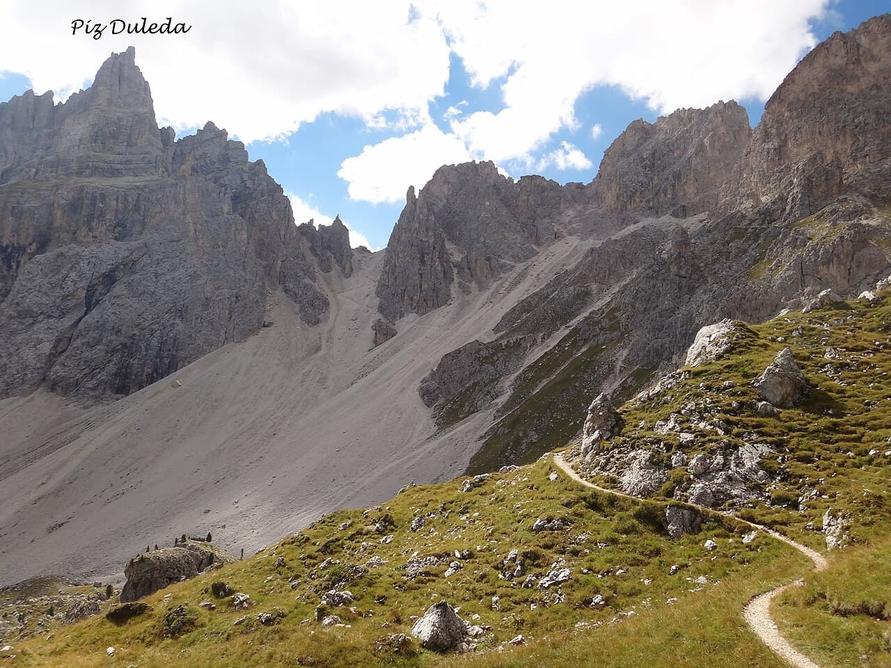 Hans Braam · CC BY 3.0
- Distance
- ≈ 102.5 mi; see measurement notes
- Ascent
- ≈ 37,730 ft; see measurement notes
- Descent
- ≈ 36,089 ft; see measurement notes
- Time
- Usually 13 days; see measurement notes
Measurement notes
- Distance
- Approximate sum of 13 connected walking stages from Bressanone through Fedaia, Malga Ciapela and Passo delle Lede to Croce d’Aune. Includes the Fedaia road walk; excludes lifts, transfers, Marmolada glacier/Contrin alternatives, side trips and the Feltre extension. Publisher/provincial/operator stage estimates use differing measurement methods; distance rounded to 5 km, gain and loss separately to 100 m. Stage substitutions and endpoint arithmetic are recorded in the research calculation, not a surveyed route profile. Route context only; not a training target, technical qualification or current-conditions report.
- Ascent
- Approximate sum of 13 connected walking stages from Bressanone through Fedaia, Malga Ciapela and Passo delle Lede to Croce d’Aune. Includes the Fedaia road walk; excludes lifts, transfers, Marmolada glacier/Contrin alternatives, side trips and the Feltre extension. Publisher/provincial/operator stage estimates use differing measurement methods; distance rounded to 5 km, gain and loss separately to 100 m. Stage substitutions and endpoint arithmetic are recorded in the research calculation, not a surveyed route profile. Route context only; not a training target, technical qualification or current-conditions report.
- Descent
- Approximate sum of 13 connected walking stages from Bressanone through Fedaia, Malga Ciapela and Passo delle Lede to Croce d’Aune. Includes the Fedaia road walk; excludes lifts, transfers, Marmolada glacier/Contrin alternatives, side trips and the Feltre extension. Publisher/provincial/operator stage estimates use differing measurement methods; distance rounded to 5 km, gain and loss separately to 100 m. Stage substitutions and endpoint arithmetic are recorded in the research calculation, not a surveyed route profile. Route context only; not a training target, technical qualification or current-conditions report.
- Time
- Thirteen-stage walking example from Bressanone through Fedaia/Malga Ciapela and Passo delle Lede to Croce d’Aune. The guide’s stage thirteen reaches Croce d’Aune before the optional road walk to Feltre, which is excluded here. Historical itinerary structure, not current hut availability; equipped passages remain part of this non-glacier route. Route context only; not a training target, technical qualification or current-conditions report.
The journey
- Bressanone and PloseNorthern approach
- Genova and PuezHut traverse
- Pisciadù and BoèEquipped mountain passages
- Fedaia and Malga CiapelaSelected non-glacier corridor
- San Pellegrino and VallesPass crossings
- Mulaz, Rosetta and PradidaliContinue through the Pale di San Martino
- Lede, Treviso and CeredaSouthern mountain stages
- Croce d’AuneFinish via Bruno Boz and Dal Piaz
Route sequence only; use the official route information ↗ for navigation.
A demanding alpine climb, high-altitude objective or sustained trek. Glacier systems, exposed terrain, repeated long days or extended time at altitude add to the overall challenge.
For Alta Via 2 · non-glacier traverse to Croce d’Aune.
How difficulty is rated
Our five levels combine physical effort, technical skills, altitude and overall commitment for the reviewed objective or route. Different challenges can lead to the same level; the numbers are broad bands, not equal steps in effort.
- 1 · Moderate
An introductory mountain objective or substantial hike. Expect sustained walking and climbing, sometimes on snow, without the systems or commitment of higher levels.
- 2 · Demanding
Long mountain days or multi-day treks with substantial climbing, carried loads, altitude or introductory alpine terrain. The combination requires deliberate preparation.
- 3 · Challenging
A demanding alpine climb, high-altitude objective or sustained trek. Glacier systems, exposed terrain, repeated long days or extended time at altitude add to the overall challenge.
- 4 · Very challenging
Sustained exposed technical climbing or a major expedition commitment. Technical complexity, heavy carries, altitude, remoteness or prolonged duration can drive this level.
- 5 · Extreme
An 8,000-meter expedition or another explicitly reviewed objective with comparable overall commitment. Exceptional altitude, expedition systems and sustained demands define this band.
Check the route details for the demands behind its level. Conditions and itinerary choices can change the challenge. This rates the objective, not your personal preparation.
Local training hikes have not been assigned an overall level. “Not rated” means no reviewed rating; it does not mean easy. They appear last when sorting by difficulty.
What to expect
- Trip pattern
- Hut-to-hut walking over successive days.
- Walking terrain
- Exposed rocky mountain trail with equipped passages
Before you make a plan
Check permits, reservations, access and current conditions for your chosen route and dates.
Sources and route notes
Bressanone → Plose → Genova / Schlüter → Puez → Pisciadù → Boè → Passo Pordoi → Lago Fedaia → Malga Ciapela → Passo San Pellegrino → Passo Valles → Mulaz → Rosetta → Pradidali → Passo delle Lede → Minazio → Treviso → Passo Cereda → Bruno Boz → Giorgio Dal Piaz → Passo Croce d’Aune. Sustained multi-day mountain traverse with protected/equipped passages and repeated ascent/descent. Non-glacier routing via Fedaia and Malga Ciapela does not mean nontechnical or guaranteed snow-free.
Review through Dec 20, 2026. Historical maps and photographs do not establish current conditions.
trail: Reviewed itinerary context, not live access, a member workload or technical certification.
consecutive day role: Reviewed itinerary context, not live access, a member workload or technical certification.
preview ascent: Approximate sum of 13 connected walking stages from Bressanone through Fedaia, Malga Ciapela and Passo delle Lede to Croce d’Aune. Includes the Fedaia road walk; excludes lifts, transfers, Marmolada glacier/Contrin alternatives, side trips and the Feltre extension. Publisher/provincial/operator stage estimates use differing measurement methods; distance rounded to 5 km, gain and loss separately to 100 m. Stage substitutions and endpoint arithmetic are recorded in the research calculation, not a surveyed route profile. Route context only; not a training target, technical qualification or current-conditions report.
preview descent: Approximate sum of 13 connected walking stages from Bressanone through Fedaia, Malga Ciapela and Passo delle Lede to Croce d’Aune. Includes the Fedaia road walk; excludes lifts, transfers, Marmolada glacier/Contrin alternatives, side trips and the Feltre extension. Publisher/provincial/operator stage estimates use differing measurement methods; distance rounded to 5 km, gain and loss separately to 100 m. Stage substitutions and endpoint arithmetic are recorded in the research calculation, not a surveyed route profile. Route context only; not a training target, technical qualification or current-conditions report.
distance: Approximate sum of 13 connected walking stages from Bressanone through Fedaia, Malga Ciapela and Passo delle Lede to Croce d’Aune. Includes the Fedaia road walk; excludes lifts, transfers, Marmolada glacier/Contrin alternatives, side trips and the Feltre extension. Publisher/provincial/operator stage estimates use differing measurement methods; distance rounded to 5 km, gain and loss separately to 100 m. Stage substitutions and endpoint arithmetic are recorded in the research calculation, not a surveyed route profile. Route context only; not a training target, technical qualification or current-conditions report.
itinerary days: Thirteen-stage walking example from Bressanone through Fedaia/Malga Ciapela and Passo delle Lede to Croce d’Aune. The guide’s stage thirteen reaches Croce d’Aune before the optional road walk to Feltre, which is excluded here. Historical itinerary structure, not current hut availability; equipped passages remain part of this non-glacier route. Route context only; not a training target, technical qualification or current-conditions report.
Full reviewed claims and assumptions
What it asks of you
Objective-wide planning ranges apply only to the reviewed scope below. They are not a selected route profile, a fitness threshold, or evidence of your skills.
Reviewed scope and assumptions
- Reviewed scope
- Alta Via 2 (Dolomites) objective in the Summer hut traverse with non-glacier routing; equipped sections remain. Snow/ice or impassable equipped sections require a current local route review, not assumed seasonal clearance. No route or fixed daily schedule selected. Protected-section capability remains a material requirement.
- Area
- Dolomites, Italy
trail
exposed rocky mountain trail with equipped passages
Scope, sources and review
Explicit assumption
- Reviewed itinerary context, not live access, a member workload or technical certification.
- Official Belluno tourism AV2 ↗
- Dolomiti Bellunesi National Park — AV2 ↗
- Official Belluno tourism AV2 guide ↗
Reviewed 2026-09-28 · evidence expires 2026-12-20
consecutive day role
multi-day hut traverse
Scope, sources and review
Explicit assumption
- Reviewed itinerary context, not live access, a member workload or technical certification.
- Official Belluno tourism AV2 ↗
- Dolomiti Bellunesi National Park — AV2 ↗
- Official Belluno tourism AV2 guide ↗
Reviewed 2026-09-28 · evidence expires 2026-12-20
Unlisted demands are not reviewed here; missing pack weights or weekly training targets are unknown, not zero. Confirm permit, access, equipment and conditions for your exact route and dates with the official sources.
Route-specific demand
Alta Via 2 · non-glacier traverse to Croce d’Aune
- Reviewed scope
- Bressanone → Plose → Genova / Schlüter → Puez → Pisciadù → Boè → Passo Pordoi → Lago Fedaia → Malga Ciapela → Passo San Pellegrino → Passo Valles → Mulaz → Rosetta → Pradidali → Passo delle Lede → Minazio → Treviso → Passo Cereda → Bruno Boz → Giorgio Dal Piaz → Passo Croce d’Aune. Sustained multi-day mountain traverse with protected/equipped passages and repeated ascent/descent. Non-glacier routing via Fedaia and Malga Ciapela does not mean nontechnical or guaranteed snow-free.
- Start
- Bressanone / Brixen, walking start
- End and return
- Passo Croce d’Aune; onward transfer to Feltre excluded
- Includes
- Park southern stages are Cereda–Boz, Boz–Dal Piaz and Dal Piaz–Croce d’Aune; Feltre is onward transport. The official guide anchors the northern chain and non-glacier Marmolada bypass. Full-route aggregate figures are not single-day training targets.
- Excludes
- Marmolada glacier/summit alternative
- Excludes
- Added summit ferratas
- Excludes
- Winter and camping itinerary
- Excludes
- Cable-car shortcuts or transport counted as walking
- Excludes
- Transfer from Croce d’Aune to Feltre
- Excludes
- Valle d’Aosta Alta Via 2
- Season assumptions
- Summer hut traverse with non-glacier routing; equipped sections remain. Snow/ice or impassable equipped sections require a current local route review, not assumed seasonal clearance.
- Itinerary assumptions
- Hut stages/booking dates require member confirmation; no fixed daily schedule inferred.
trail
exposed rocky mountain trail with equipped passages
Scope, sources and review
Explicit assumption
- Reviewed itinerary context, not live access, a member workload or technical certification.
- Official Belluno tourism AV2 ↗
- Dolomiti Bellunesi National Park — AV2 ↗
- Official Belluno tourism AV2 guide ↗
Reviewed 2026-09-28 · evidence expires 2026-12-20
consecutive day role
multi-day hut traverse
Scope, sources and review
Explicit assumption
- Reviewed itinerary context, not live access, a member workload or technical certification.
- Official Belluno tourism AV2 ↗
- Dolomiti Bellunesi National Park — AV2 ↗
- Official Belluno tourism AV2 guide ↗
Reviewed 2026-09-28 · evidence expires 2026-12-20
Route reviewed 2026-09-28 · review expires 2026-12-20. These demands apply only to this route and its stated assumptions.
Sources and review
- Official Belluno tourism AV2 ↗
- Dolomiti Bellunesi National Park — AV2 ↗
- Official Belluno tourism AV2 guide ↗
Reviewed 2026-09-28 · review expires 2026-12-20. Dates reflect operator review, not current route conditions — check conditions before you go.